
How a Doddridge County Property Search Works
Begin with the search key you already know. The statewide WV Property Assessment application is the broad route, taking an address, owner, or parcel lookup. The local Doddridge Map Card Viewer is narrower. Choose district, map, and parcel, then press Show. The public material does not display every live result field, so do not expect a sale price or a full title history on the local card. Treat it instead as a way to identify the assessor record and its map references. Carry what you learn onward. Take the owner's name, parcel label, legal description, book/page, or instrument number into the next system. County Records Inquiry searches recorded instruments by party and reference, and the statewide parcel viewer can help orient the surface parcel. This handoff matters. In a Doddridge property search, an address is not the main key in the deed index.
- Enter the street address, owner name, or parcel in the statewide WV Property Assessment search.
- Record the Doddridge district and the map/parcel label that identifies the assessment entry.
- Use that label in the local Map Card Viewer if a county map card is needed.
- Search the County Records Inquiry by party, date, book/page, or instrument number to find a deed.
- Check the surface parcel in WV Property Viewer and ask the custodian for copies the screen does not show.
This state assessment search capture shows the statewide entry point used for Doddridge parcels.
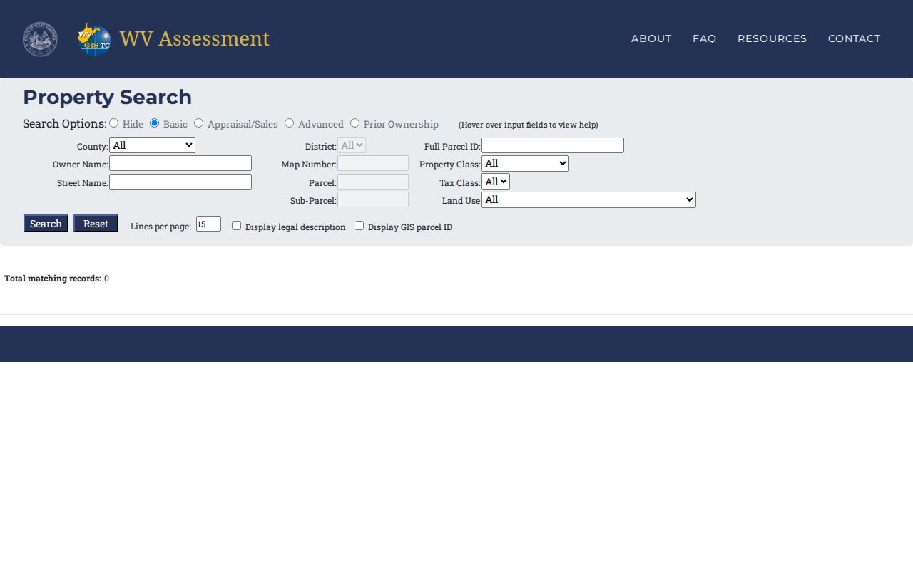
The statewide search uncovers the property key. Ownership details worth relying on should then be confirmed in the County Clerk record.
Doddridge's Local Map Card Controls
The local Assessor viewer skips a full address form. Nine district choices appear. They are Central, Cove, Grant, Greenbrier, McClellan, New Milton, Southwest, West Union, and West Union Corp. Choose the district first. West Union Corp is a separate district from West Union, a split that can help resolve a local label but proves nothing about annexation history.
Map card copies require an Assessor office visit. The site notice says as much. If you know the address but not its local map label, start with the statewide property search. The county assessor's office is at 99 Court Street, Suite 236, West Union, reachable at 304-873-1261. Call ahead to confirm current access and copy steps.
See the Doddridge Map Card Viewer, which presents the same district and map/parcel controls.
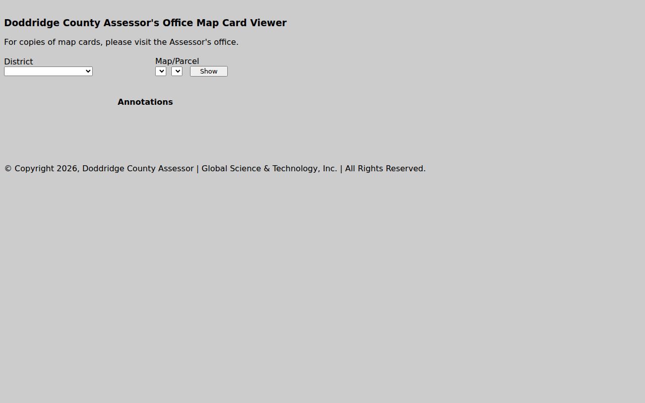
The control labels make useful search clues. By themselves, they do not reveal every data field stored in a completed map card.
Fields in the Doddridge Property Search
The statewide application offers several property-search modes, though its live field inventory is not fully published. The table separates documented search paths from unlisted controls. Some modes are certain. Others remain unconfirmed. Use the local district and map selectors only after the property is identified, and never rely on a guessed county code or an untested partial-match rule.
| Search field | Role | What is confirmed |
|---|---|---|
| Address | Find a situs location | Statewide search mode; exact match behavior not verified. |
| Owner / name | Find a listed party | Official property-search route; partial-match rules not verified. |
| Parcel ID | Retrieve a known parcel | Full and abbreviated formats are described by the state. |
| County | Limit statewide results | Doddridge is one of the 55 counties. |
| District / Map / Parcel | Open a local map card | Local controls visibly offer district and map/parcel selection. |
Step back when no key yields a confident match. Do not cycle through unverified assumptions. Check whether the address is a tax mailing address rather than the physical situs. Try a known former owner from a deed. The Assessor can confirm the local district and map/parcel. With an instrument number or book/page reference, go straight to County Records Inquiry. Some categories, including military discharges, carry restricted access. A public index does not guarantee viewing or copying rights for every requester.
A statewide root Parcel ID can include county and district codes, map number, parcel prefix, parcel suffix, and special ID. The official text does not state Doddridge's county code. Copy the identifier from a trusted result. Never build one from another county's sample.
Keep the full identifier intact between screens. Leading zeros, punctuation, and suffixes all matter. The state viewer's parcel key and the County Assessor's district/map/parcel controls describe related records, yet they are not always entered in the same format. If a search box rejects a copied string, return to the source record. Separate the district, map, and parcel values rather than guessing which characters to drop. Guesswork causes most failed matches. That habit helps most when a deed cites a tract name or legal description instead of a street address.
What a Doddridge Property Search Record Shows
The local viewer is sparse. It shows District, Map/Parcel selectors, and a Show control. The state viewer describes unique parcel identifiers, surface geometry, ownership and location information, assessment attributes, and map layers. The public pages do not publish card details. Owner, mailing, situs, sale, and value-history fields should be checked on the live result or requested from the Assessor.
| District | Local map-card control that narrows the county's map. |
|---|---|
| Map / Parcel | Local selectors used with a district and the Show button. |
| Parcel ID | State-defined identifier made from six parts; copy the displayed Doddridge value. |
| Surface geometry | Reference parcel outline, not a legal survey. |
| Assessment attributes | Annual tax-assessment information described by the state system. |
| Layer context | May include aerial, flood-hazard, or delinquent-land data. |
A search result does not show every deed. Nor does it settle ownership after a sale. WV Property Assessment updates annually, and the state warns a simple ownership change may not appear yet. County Records Inquiry and the latest recorded deed offer a separate route to a transfer. And a map outline never establishes surveyed boundaries.
Why a Recent Doddridge Transfer May Look New
Timing explains most surprises in Doddridge County property records. The state assessment system posts fresh annual data whenever the tax assessment gets updated. So a deed can be recorded well before the new owner of record shows up in the assessment viewer. For transfers between July 1 and June 30, the state requires parcel-line map changes by February 1 of the following calendar year, and it suggests calling the local Assessor if the lines still look wrong after two years.
That map deadline is not an update clock for the owner-name field. No fixed lag applies. When current ownership matters, the recorded deed is the more direct transfer record, so pull it and ask the Assessor how the roll stands. This distinction sits at the heart of a careful Doddridge County property search.
Keep two labels together: the deed's recording date and the assessment year. A tax bill or card copy may trail the deed by a cycle. And if the GIS map shows different acreage than the deed, the deeded acreage controls. Ask the Assessor about the GIS calculation rather than trusting the screen. A mismatch is usually a mapping or timing quirk, not proof that the transfer failed.
Searching Doddridge Parties by Name
The County Records Inquiry shines once you hold a party name or an instrument reference. A street address alone gets you less. The portal offers From and Thru dates. It also has a Starts With or Exact name filter. Fields for Last Name, First Name, Middle Name, Book, Page, and Instrument Number round out the form. The system does not say how it treats partial first names. So try likely spellings and initials, then read the document context before tying a result to the right parcel.
Trace transfers through both grantor and grantee roles. A seller in one deed was often the buyer in the one before it. Trusts, estates, companies, and fiduciaries appear under formal legal names. The state business search can clarify a corporation's or LLC's registered name and agent. That lookup alone proves nothing about who owns the land.
A common surname in Doddridge County can bury the deed you need. Narrow the From/Thru range to the likely transfer year first. Then alternate between Starts With and Exact if the name stays hidden. Preserve the spelling and the role exactly as the instrument shows them. The portal's Search, Selections, Advanced, and View modes manage results differently. The portal does not state whether every selection exports. It also does not say whether images come at no charge. When another document cites a book and page, that reference beats a broad party search every time.
Address Labels Across Doddridge County
Rural routes and community labels can make an address search less precise than an owner or parcel lookup. West Union uses ZIP 26456, Smithburg appears as 26436, and Center Point shows up with ZIP 26339 in state records. The Center Point library carries a Salem 26426 mailing address. Doddridge County publishes no complete, verified set of ZIP boundaries, and New Milton's ZIP is not stated in these materials.
A ZIP or postal city never proves a municipal boundary. Compare the physical situs address against the tax-mailing address, the local district, and the deed description. If a current address is wrong, the Assessor's change-of-address form must come from the owner or an authorized person with power of attorney. The Assessor states no exact processing time for that form.
For a rural parcel, keep every address form that appears on a deed, assessment entry, or letter from the owner. Run the statewide search first to pin down the assessment identity. Then turn to the local map-card selectors with the district and parcel details it returns. A failed street lookup does not mean the parcel is missing. It may sit under a route number, a community label, a prior owner, or a map ID. Doddridge County publishes no street-number history, postal boundary layer, or universal address-normalization rule.
Choose an Address, Owner, or Parcel Search
Each search key solves a different Doddridge County problem. An address works when you start from a place. An owner name fits when your subject signed an instrument. A parcel number is strongest once the property is already identified. Reformatting between the statewide and local systems can bend the parcel string, so keep the original result on screen as you move between portals.
| Search Key | Best For | Where It Works | Watch Out |
|---|---|---|---|
| Address | Locate a known place | WV Property Assessment / WV Property Viewer | Postal and situs labels may differ. |
| Owner name | Find a listed party or deed reference | Assessment search / County Records Inquiry | Trusts, estates, entities, and similar names need care. |
| Parcel number | Return to a known tax-map identity | State and local Assessor tools | Copy the format from the result; do not guess county code. |
Not a title search. A Doddridge property search is a path to public records, not a guarantee that title is clear or every older instrument has been indexed. Use the recorded deed and professional title review for a transaction.