
How to Search Center Point Property Records
Center Point property records sit at the county level. Start with WV Property Assessment. Search by address, owner, or parcel clue, then keep the district and map/parcel label the result displays. The statewide viewer covers surface parcels. For an ownership transfer, search the County Clerk's inquiry by party or instrument reference, and use the County Assessor's district and map selectors when you need a local map card. Center Point publishes no online permit or zoning portal. Ask the local governing body about town-level records rather than assuming one exists online.
- Search the Center Point place or owner in WV Property Assessment.
- Copy the parcel and district/map/parcel references from the county result.
- Compare the latest deed or recorded plat in County Records Inquiry.
- Use WV Property Viewer as a surface-map reference and preserve the deed description.
- Ask the local governing body directly about permits; no online lookup was located.
The Doddridge property search steps explain the county system that serves Center Point addresses.
Where Center Point Property Records Are Kept
Deeds and recorded plats for Center Point land go to the Doddridge County Clerk. Assessment and tax-map records sit with the County Assessor. The public statewide viewer adds parcel context. The library and the historic bridge records round out the local picture, but neither is a property registry, and no city permit search exists.
Doddridge County Record Custodians
County Clerk for deeds and plats; Assessor for values and maps.
County Clerk: 99 Court Street, West Union, 304-873-2631.
Center Point Local Permits
No online permit or zoning index was verified.
Ask the local governing body which office holds a record.
Current municipal contact was not verified.
Center Point and Salem ZIP Clues
Center Point shows up with ZIP 26339 in state agency and business records. The Center Point Public Library tells a different story. It is listed at 8871 WV Route 23, Salem, ZIP 26426. One community, two postal labels. That split reflects postal routing, not a ZIP-boundary crossing, an annexation, or a municipal edge.
For an older parcel, search both names. Try the Center Point place name and whatever postal label the document carries. Then compare the legal description against the Assessor parcel. A postal city is only a mailing clue. Situs identifies the physical place. The exact ZIP boundary, including New Milton coverage, is not spelled out in public sources, so keep both clues instead of rejecting a Salem record.
Center Point Library Adds a History Lead
Doddridge County's library system added a Center Point branch in 1978. A new building opened in 2019. The official record lists the branch on WV Route 23 under the Salem postal label, which makes it a natural first stop. Ask there about local newspapers, photographs, family notices, or community history.
Exact holdings years are not published. The branch lists no start dates for city directories, obituary indexes, newspaper microfilm, or licensed genealogy services, so ask what it holds before citing a collection or date range. A library item can point toward a prior owner or a house story. It cannot settle ownership, though. The County Clerk's deed and probate records settle that.
The Center Point Public Library listing records the branch's Route 23 address and its library history.
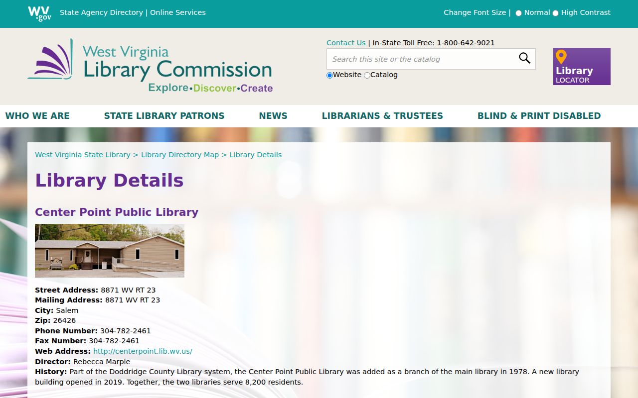
Treat this local-history source as a starting point. To confirm who owns a property in Doddridge County, check the recorded deeds and related county property records.
Center Point's Covered Bridge
The West Virginia Department of Transportation's historic-resource record documents the Center Point Covered Bridge. It is an 1889 Long truss. Builders John Ash and S. H. Smith crafted the span. It measures 42 feet by 12.5 feet. The bridge crosses Pike Fork of McElroy Creek. Rehabilitation work came in 2002. Details like these anchor a Center Point house-history search to a documented place.
A bridge record is not a parcel plat. It proves no boundary. Treat it as geographic and historical context, then compare a nearby deed's legal description, the county map, and any recorded plat. No parcel range is keyed to the bridge area.
The dimensions and repair date still earn their keep, distinguishing this landmark from other crossings named in a deed or historical account. That matters in old accounts. For a nearby parcel, treat the stream and road references as orientation only, since a modern tax map may not label the historic tract the same way. A recorded plat or a deed description must connect a specific lot to the bridge vicinity. A disputed line takes a survey. The state bridge record is the official source for the landmark.
WV Route 23 and Center Point Addresses
WV Route 23 is the address clue tied to the Center Point library branch. A road name helps narrow a Doddridge County property search, though the Assessor publishes no complete street-wide result list. Enter a known situs address in the state property search, then carry the parcel number into the local Map Card Viewer.
When a modern address comes up empty, try the owner name, a postal-city variant, or the parcel label from a deed. The statewide addressing and mapping system runs through WV DHSEM, and property-data address corrections go to local authorities. The Assessor's change form requires the owner of record or a person holding legal power of attorney. The office states no processing time.
The Center Point Library listing at 8871 WV Route 23 uses Salem 26426, while Center Point appears with 26339 in other state records. Keep both forms handy when searching older deed records or requesting a local-history source. Neither ZIP proves a typo, an address change, or a community boundary line. The full ZIP geography simply is not published.
Center Point Permits Need Local Confirmation
Center Point publishes no permit, zoning, or code-case portal. A similarly named out-of-state city site is not a substitute. Construction, floodplain, and ordinance files sit with whichever local body holds them. Ask that body directly. County floodplain and emergency-mapping resources exist, but a permit database does not.
Deeds, liens, plats, assessments, and tax maps belong to the Doddridge County custodians. A town may keep minutes or ordinances explaining local administration. No current Center Point municipal contact or online search form appears in county listings. Direct any public-records request to the body that created or maintains the specific document.
Center Point Subdivision Names in Records
Doddridge County records contain no official list of named Center Point subdivisions. They also list no local plat range. Treat the covered bridge and the library as landmarks, not subdivision names. County deed records separate map labels from recorded legal descriptions, and the difference matters. A landmark can orient a property search. Only a deed or plat ties a lot to a specific name.
| Neighborhood / Subdivision | Era | In the Records |
|---|---|---|
| Named subdivisions | Not verified | Ask the County Clerk for plats cited in a deed. |
| Center Point locality | Community name in official sources | Use as a search clue, not a plat title. |
| Pike Fork bridge area | Historic landmark context | Not a subdivision or parcel boundary. |
Copy the recording reference whenever a deed cites a plat, then ask the County Clerk how to pull the map. Match the written lot description against the Assessor parcel and the state viewer. Remember that GIS lines serve only as a reference. The Doddridge parcel-map guidance draws that distinction clearly.
Center Point Property Value Is Countywide
Center Point sits inside the Doddridge County assessment system. No municipal assessor exists, and no separate city value trend is published. The county applies the West Virginia assessment framework and classifies each parcel through the Assessor. Read any value with its assessment year and district. A parcel figure is not a Center Point market report.
Question a value you think is wrong? Ask the Assessor about the current review process. The Board of Equalization and Review follows the statewide February calendar. Local notices should be checked each year. A tax assessment is neither an appraisal nor a sale price.
The calendar works like this. Assessment books close by January 30. They reach the Board by February 1. Values are certified by March 3. The Board adjourns by the last day of February. That timing is statewide law, not a Center Point valuation program. Keep the parcel's map identity and assessment year handy. Consult the current notice for hearing details.
The Assessor classifies property under the statewide system. A Salem mailing address or a Center Point place label cannot settle the question. It cannot establish whether a parcel lies inside a municipality for Class III or Class IV purposes. Ask which tax district and property class apply. The county operates no separate town assessment office. It offers no market report or local tax bill portal for Center Point.
What Center Point Property Records Cannot Prove
Center Point property records point to county-held deeds, assessment details, map references, and other recorded filings in Doddridge County. They cannot prove everything. A GIS line is never an exact boundary. An old address may not match a current one. Not every permit carries an online index, either. The bridge and library histories offer place clues, not title evidence, so review the controlling deed and seek professional help for any boundary or ownership decision.
Lawful use. Use Center Point records for property history, boundary diligence, and civic research. Do not use owner information to stalk, threaten, harass, or harm anyone.